
A Comparison of the Traditional Method and the Use of Technology Portable Personal Computer in the Process of Village Survey
Article Sidebar
Main Article Content
Abstract
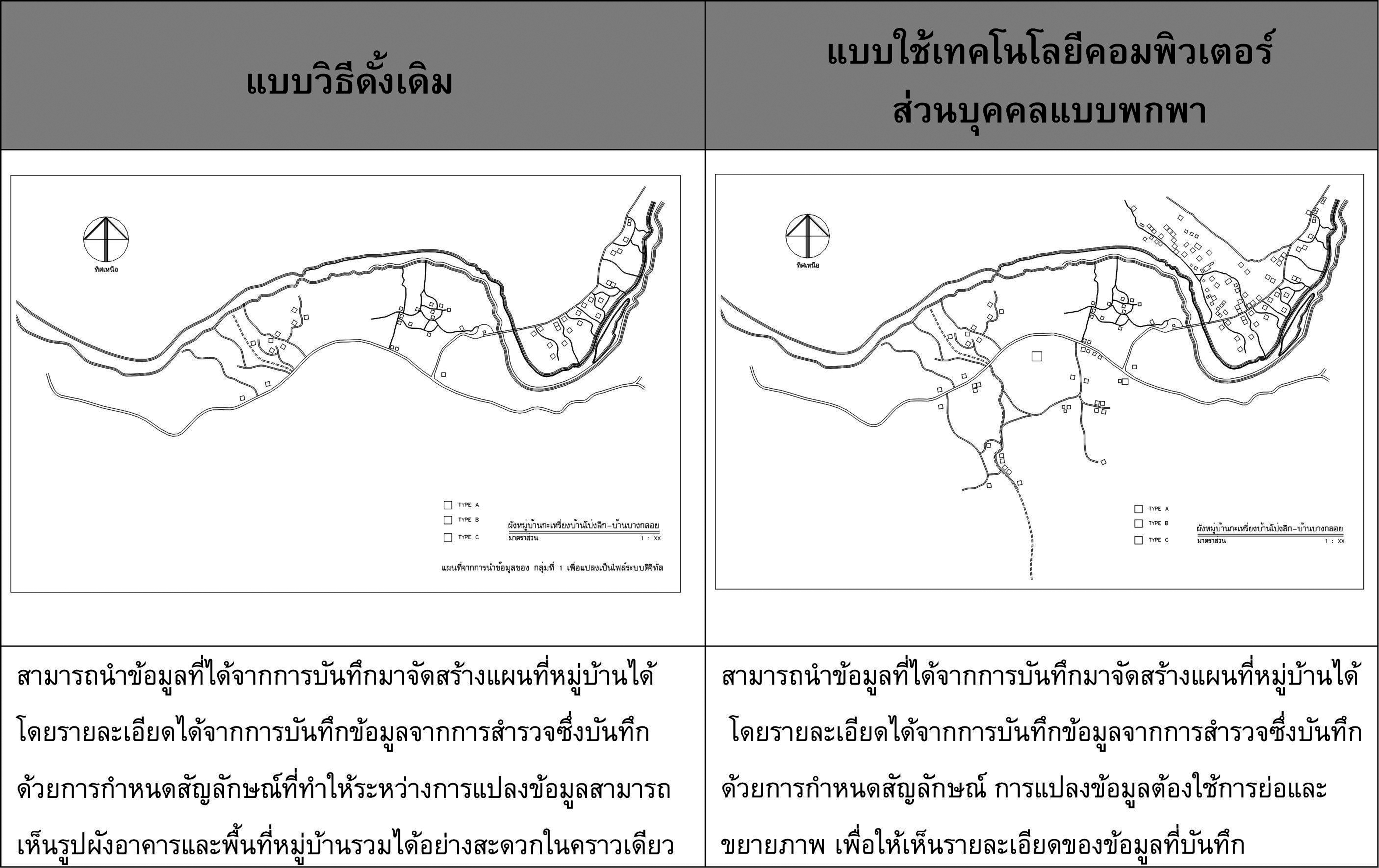
A survey of the village is the process of collecting basic data to be used in the development plan of the village. Nowadays, it requires the development of data collection operation. This research was conducted to compare the traditional method and the use of technology portable personal computer in the process of making a village map and in the process of an architectural measure works. The study was found that the process of making the village map, which was the area operation, the use of technology of portable personal computer had advantages over the traditional method in all 3 steps. Especially during operations, it could save data by using symbols instead of conveying the information without the limitations of a device, such as a logo, color, and size of the line. As for the process of architectural measure works, which was the dimension of insight operation, the traditional method had advantages rather than the use of the technology portable personal computer. However, there were still some weaknesses, which was limited to the technology portable personal computers could be applied to reduce various restrictions effectively.
Downloads
Article Details

This work is licensed under a Creative Commons Attribution-NonCommercial-NoDerivatives 4.0 International License.
All material is licensed under the terms of the Creative Commons Attribution 4.0 International (CC-BY-NC-ND 4.0) License, unless otherwise stated. As such, authors are free to share, copy, and redistribute the material in any medium or format. The authors must give appropriate credit, provide a link to the license, and indicate if changes were made. The authors may do so in any reasonable manner, but not in any way that suggests the licensor endorses you or your use. The authors may not use the material for commercial purposes. If the authors remix, transform, or build upon the material, they may not distribute the modified material, unless permission is obtained from JARS. Final, accepted versions of the paper may be posted on third party repositories, provided appropriate acknowledgement to the original source is clearly noted.
References
Department of water management brance. (2015). เพรชรบุรี [Phetburi]. Retrieve August 30,2016, from http://irrigation.rid.go.th/rid14/om/wmb14/pic/map/pet_22.jpg
Ministry of Natural Resources and Environment. (2015). แก่งกระจาน [Kaeng Krachan]. Retrieved January 10, 2015, from http://park.dnp.go.th/visitor/nationparkshow.php?PTA_CODE=1028.
National Electronics and Computer Technology Center [NECTEC]. (2015). How community survey. Retrieved january 28, 2015, from http://www.nectec.or.th/schoolnet/library/webcontest2003/100team/dlns058/plan/plan.html
Piriyawat S. (2009). แนวทางการปฏิบัติสำหรับการสำรวจภาคสนาม [Guidelines for survey field practice]. Chonburi, Thailand: Burapha University.
Royal Thai department.(2012). การใช้โปรแกรมภูมิสารสนเทศในการสร้างแบบจำลองความสูงสามมิติของภูมิประเทศ : กองยีออเดซี่และยีออฟิสิกส์[Usage geographic information for regeneration on 3D modelling: Geodesy and Geophysical]. Bangkok, 1-5
The Royal Initiative Discovery Foundation. (2015a). Information of condition. Retrieved January 10, 2015, from http://www.pidthong.org/project-detail.php?id=236
The Royal Initiative Discovery Foundation. (2015b). Rural development plan for spatial applications for Karen. Retrieved February 17, 2015, from http://www.pidthong.org/project-detail.php?id=236
