Development Area by Using City Image Perception Based on Patterns of the Land Use
Main Article Content
Abstract
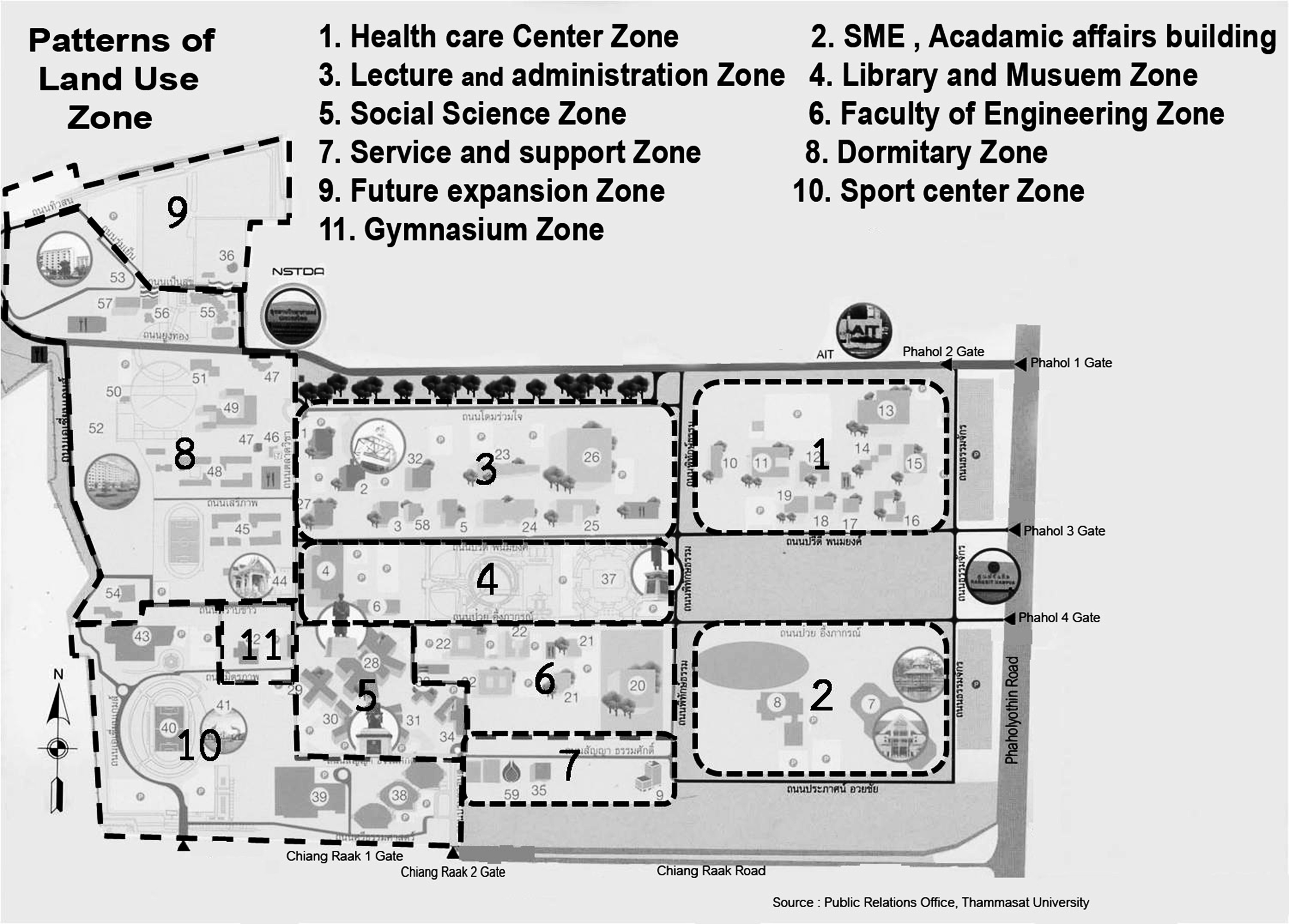
This article aims to analyze image perception in land based on patterns of the land use: dispersed and compact patterns. The main purposes of the study are: 1) to study patterns and types of building and land use in the target universities in order to be representative of dispersed and compact patterns, 2) to evaluate image perception, and 3) to raise issues and proper development on city image perception based on patterns of the land use. The results show that Thammasat Rangsit campus has been considered as a representative of dispersed pattern because of low intensity of building and land use. Non-fully potential land use. The participants felt that it is difficult to engage in image perception when entering into the place, got lost, due to the complicated structure of the land. Image perception is suggested to be brought as a facilitating factor dictating travelling behavior. The cognition in network of the route and recognisable symbol can be applied by installing a clear indicating sign at the most recognisable points. Srinakharinwirot Prasarnmit campus, it has been considered as a representative of compact pattern of land use. This is due to the fact that the university has an effective land management. Even though the place has a limitation in size, and a high intensity of building and land use are found, yet, the image perception shows that the participants were not nearly get lost. They felt that the land is complicated. A navigation, directional sign and referable points are recommended to solve the problem.
Downloads
Article Details

This work is licensed under a Creative Commons Attribution-NonCommercial-NoDerivatives 4.0 International License.
All material is licensed under the terms of the Creative Commons Attribution 4.0 International (CC-BY-NC-ND 4.0) License, unless otherwise stated. As such, authors are free to share, copy, and redistribute the material in any medium or format. The authors must give appropriate credit, provide a link to the license, and indicate if changes were made. The authors may do so in any reasonable manner, but not in any way that suggests the licensor endorses you or your use. The authors may not use the material for commercial purposes. If the authors remix, transform, or build upon the material, they may not distribute the modified material, unless permission is obtained from JARS. Final, accepted versions of the paper may be posted on third party repositories, provided appropriate acknowledgement to the original source is clearly noted.
References
Adams, D. (1994). Urban planning and the development process. London: UCL Press.
Boonlua, T. (2009). The housing development planning and Slum upgrading/prevention projects in Sa Kaeo province. Faculty of architecture urban design and creative arts, Maha sarakham University.
Chapin, F. S., Kaiser, E. J., & Godschalk, D. R. (1979). Urban land use planning (4th ed.). Illinois: University of Illinois Press.
Google Earth Pro. (2015). Thammasat University Rangsit Campus 14°04’26.32’’N 100°36’10.22’’E, elevation 7M.Retrieved August 31, 2016, from http://www.google.com/earth/index.html.
Harbin Urban Planning Bureau. (2009). Planning experts forum. Retrieved May 9, 2014, from http://www.upp.cn/english/view/Dlannlng/article/302737.html.
Harris, J. C., & Friedman, J. P. (1997). Real estate handbook (4th ed.) New York: Barron’s Education Series Inc.
Jenks, M., & Burgess, R. (2002). Compact cities: Sustainable urban forms for developing countries (1st ed.). London: Spon Press.
Jittrakorn, J. (1982). Guidelines for rehabilitation in Bangrak district, Bangkok. Faculty of Architecture, Chulalongkorn University, Bangkok, Thailand.
Lisnund, N. (2016). Guidelines on promotion of the public space potential in the old district of Nakhon Ratchasima city. Journal of Architectural/Planning Research and Studies, 13(2), 99-122.
Lynch, K. (1960). The image of the city. Cambridge, Massachusetts: MIT Press.
Monro, J. P. (2012). Design for walking. Retrieved May 9, 2014, from http://designforwalking.com/are-paths-the-primary-component-of-landscapes.
Prasertsubpakij, D. (2014). Review article: Potential works in BMR transit-oriented development: Lesson learnedfrom the past. Journal of Architectural/Planning Research and Studies, 11(2), 1-11.
San Jose State University. (2012). Mental map. Retrieved May 9, 2014, from http://www.sjsu.edu/cfd/docs/enactAIM_hilary/sherman.jpg.
Sitachitta, P. (2010). City and land development. Teaching document of UP 243 Land use Models, Faculty of Architecture and Planning, Thammasat University.
Vankaew, A. (2007). Factors effecting underutilized land in inner city area conditional to floor area ratio measure: A case study of Silom district, Bangkok. Bachelor of Urban Environmental Planning and Development Thesis, Faculty of Architecture and Planning, Thammasat University. Bangkok, Thailand.
Whittick, A. (1974). Encyclopedia of urban planning. USA: McGraw Hill Inc.
Yamane, T. (1973). Statistic: An introductory analysis (3rd ed.). New York: Harper and Row.


